A few days ago, I had wanted to go down to the Hopewell Rocks here in New Brunswick, but the timing didn’t work out, but I did get a chance to go today. It’s about an two and a half hour drive from Fredericton. Home of some of the highest tides in the world, the Hopewell Rocks Park has some really interesting geographic landscapes. The unusual rock formations, also known as the Flower Pot rocks, are created by the erosion due to the tidal forces. Made up of sedimentary conglomerate and sandstone rock, these flower pot rocks are free-standing (as opposed to connected to the ‘mainland’), and have vegetation growing at the top.
The Bay of Fundy is an area between the south end of New Brunswick and the northwest part of Nova Scotia, and in the map below, you will see where I’ve marked where the Hopewell Rocks are located. The Bay of Fundy park is a UNESCO Biosphere Reserve. (Park Map).
![Hopewell Rocks on map [Google Maps]](https://jlstapletonphotography.me/wp-content/uploads/2011/08/hopewellrocks_map.png)
Hopewell Rocks on map [Google Maps]
The timing between high and low tides is about six hours and 13 minutes and in that time the tide can rise from 0.3 metres (1 ft) to 13.9 metres (45.6 ft), depending on the lunar cycle. You can check out the tide tables to see the different levels of tides over the year. The highest tides average 10 – 14 metres (32 – 46 ft) as 100 billion tonnes of water flow into the bay twice a day. (info from the Hopewell Rocks website). Today’s first high tide was at 8:44am at 11.7 metres (38.4 ft), and low tide was from 12:12-18:12. When it’s at low tide, you can walk on the ocean floor. At high tide, you can take a go out on a sea kayaking tour run by Baymount Outdoor Adventures, (which I did) this morning. That meant I left Fredericton a little after 5am and arrived at the park at 7:30. Of course since the park doesn’t open til 8am, I had to wait a bit, but I wanted to make sure I got there in plenty of time, since I hadn’t booked with the kayaking in advance.
I had a heavy duty dry sack that I could put my camera in, and strap it to the top of the kayak in the cross-straps for [relatively] easy access. As I was on my own for the day, I had one of the kayak guides in the two person kayak with me. We paddled in and around several of the flower pot rocks and looked in on some of the caved areas.
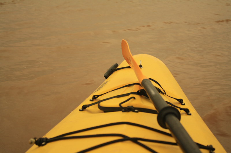
Sea Kayaking on the Bay of Fundy, 9th August 2011, © J. Lynn Stapleton
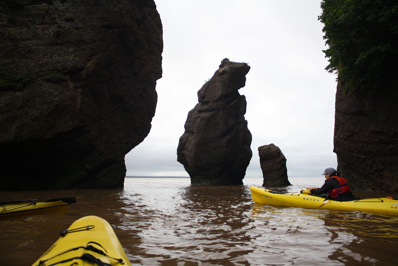
Sea Kayaking on the Bay of Fundy, 9th August 2011, © J. Lynn Stapleton
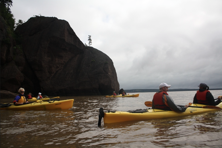
Sea Kayaking on the Bay of Fundy, 9th August 2011, © J. Lynn Stapleton
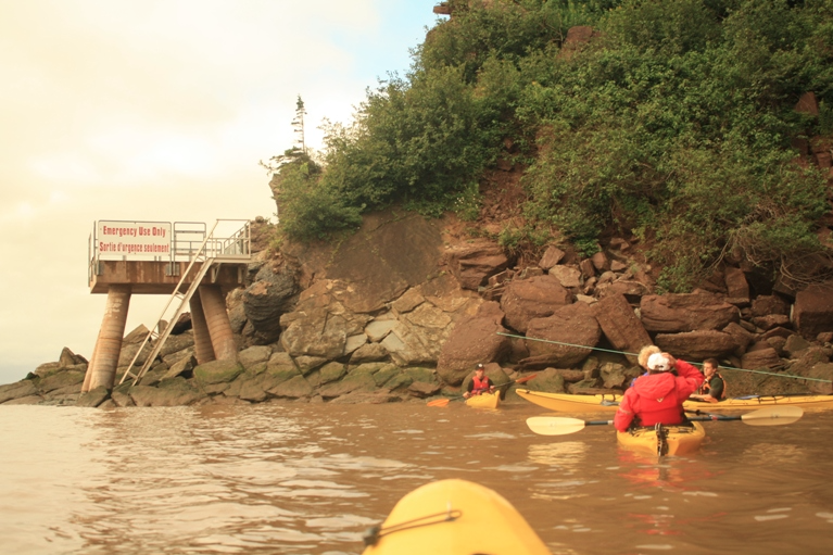
Sea Kayaking on the Bay of Fundy, 9th August 2011, © J. Lynn Stapleton
The paddling back was more challenging because we were going against the waves and wind, but it was fun and we got some more of the history of the area, the formations, and some local stories. Once on dry land, on the path back there were stations to wash off shoes/sandals/feet, so as to not track the mud from the beach into buildings. After a bit of a break by the Low Tides Cafe, I headed down the steps to the beach as the tide had gone out some. As you look through of the photos below, see some of the same rock formations with a lot less water.

Walking on the Ocean Floor, Hopewell Rocks, 9th August 2011, © J. Lynn Stapleton

Walking on the Ocean Floor, Hopewell Rocks, 9th August 2011, © J. Lynn Stapleton

Hopewell Rocks, 9th August 2011, © J. Lynn Stapleton

Hopewell Rocks, 9th August 2011, © J. Lynn Stapleton

Hopewell Rocks, 9th August 2011, © J. Lynn Stapleton
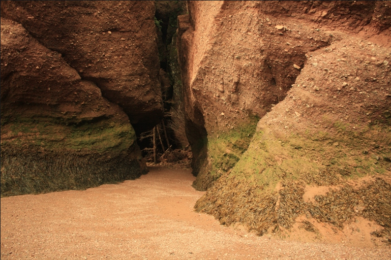
Hopewell Rocks, 9th August 2011, © J. Lynn Stapleton
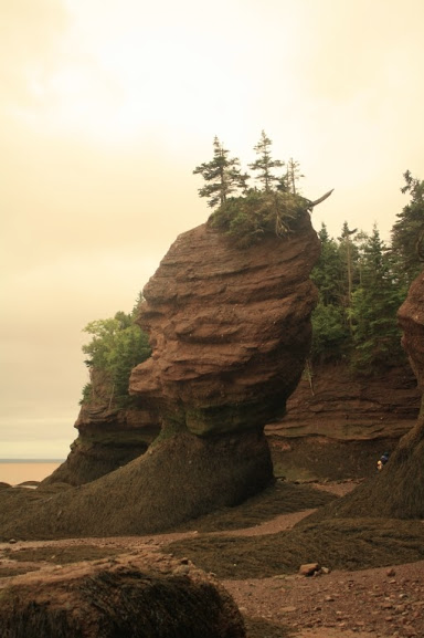
Hopewell Rocks, 9th August 2011, © J. Lynn Stapleton
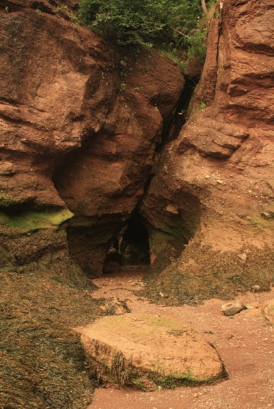
Hopewell Rocks, 9th August 2011, © J. Lynn Stapleton
The main part of this photo is of the Estrans Daniels Flats, and you can see to the far left how far out the tide had gone.

Estrans Daniels Flats, Hopewell Rocks Park, 9th August 2011, © J. Lynn Stapleton
I had a lot of fun exploring for the day, getting a chance to see both high and low tides. I finished off with a lunch at the main building and then left a little after 2pm, and I was home by 4:45. A long day, but I had a fantastic time. Stay tuned for new adventures.
