Day 3 – 28th July 2013
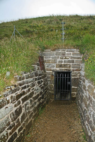
Today we set out to explore Neolithic Orkney, World Heritage sites that date back between 5100 to 3500 years ago. We visited Maeshowe chambered tomb, the Ring of Brodgar, Skara Brae, the Ness of Brodgar, and The Stones of Stenness. Inside Maeshowe, you could see the ancient Norse rune markings on the walls of the stone. The Scottish government offers a Virtual Tour of Maeshowe, wherein on the winter solstice, the sun sets in between the mountains and shone in through the 10 metre pathway to the chamber and the back wall. The mound is 35 metres in diameter and 7 metres in height. Visitors are not allowed to take photos inside, but I have a few exterior shots.
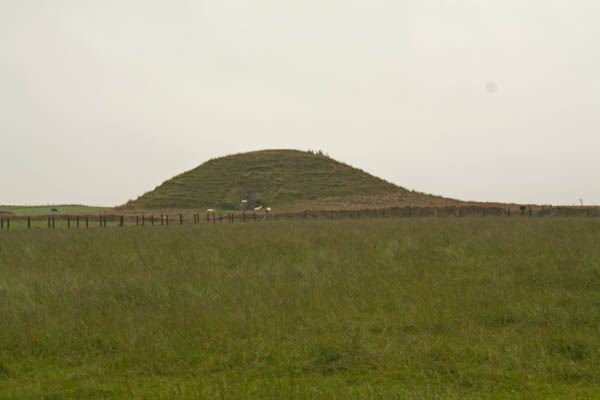
Maeshowe, Orkney. © J. Lynn Stapleton, 28th July 2013
Maeshowe, Orkney. © J. Lynn Stapleton, 28th July 2013
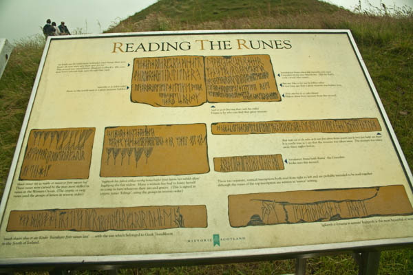
Norse Runes, Maeshowe Burial Chamber, West Mainland, Orkney. © J. Lynn Stapleton, 28th July 2013
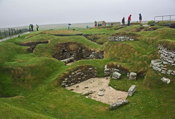
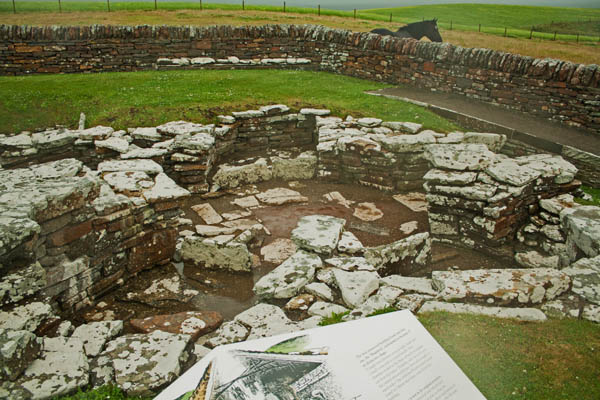
By the time we left Maeshowe, the wind and rain had picked up as we headed back to the bus to go to our next destination – the Ness of Brodgar excavations. In 2002, a geological survey of the area revealed a 2.5 hectare area that may have been indicative of a settlement. The excavations over the years since – done over a six week period each summer – has revealed settlements that have undergone radiocarbon dating to civilizations between 3200-2300BC. The site is currently only about 10% excavated at this point. The images that follow are of different sections of the excavation.
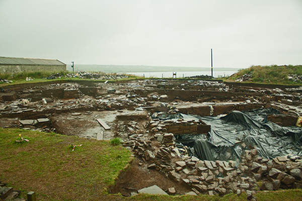
Ness of Brodgar Excavation Site, Orkney mainland. © J. Lynn Stapleton, 28th July 2013

Ness of Brodgar, Orkney mainland. © J. Lynn Stapleton, 28th July 2013
We then moved on to Skara Brae and the Skaill House. After getting some lunch at the visitor information centre and the exhibition displays, I headed out to the Skara Brae site; first to the replica house where it gave an idea to the internal structure of the homes, and then on to the actual site of one of the best preserved prehistoric villages (dating to 3100 to 2600 BC). These structures were preserved under sand until a severe storm in 1850 that revealed part of the structures, then excavations began. In the 1920s a protective seawall was erected to prevent further erosion of the historic settlements by the sea; it has been re-fortified over the years.
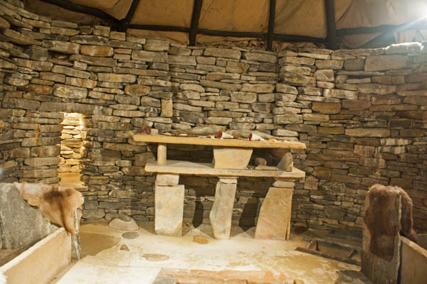
Skara Brae Replica House, Orkney mainland. © J. Lynn Stapleton, 28th July 2013
Skara Brae, Orkney mainland. © J. Lynn Stapleton, 28th July 2013
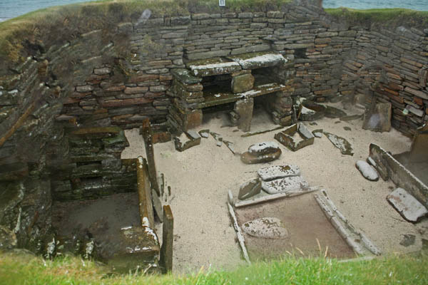
Skara Brae, Orkney mainland. © J. Lynn Stapleton, 28th July 2013
I didn’t get over to the Skaill House as the wind was up and it was pouring rain, sideways, and I was absolutely soaked so I just headed over back to the bus. We also stopped further up along the bay where a few got out to explore and see some puffins. Seeing a few of the pictures from the others, I kind of wished I had gone but I was also glad to have a bit of reprieve from the rain. By the time we got to our next destination, the Broch of Gurness, the rain had eased off somewhat, even though the wind was still up. On the plus side it helped to dry my jeans out a little. 🙂
The Broch of Gurness village is dated around 500 to 200 BC and is one of the best examples of an Iron-Age settlement in northern Scotland. We were able to wander around the settlement much easier than that of Skara Brae, and thus could see more clearly the areas of housing.
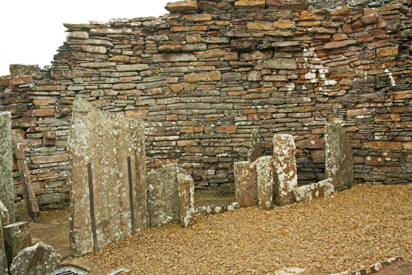
Broch of Gurness, Orkney mainland. © J. Lynn Stapleton, 28th July 2013
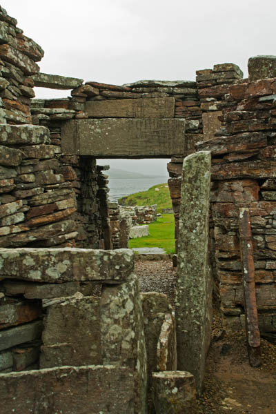
Broch of Gurness, Orkney mainland. © J. Lynn Stapleton, 28th July 2013
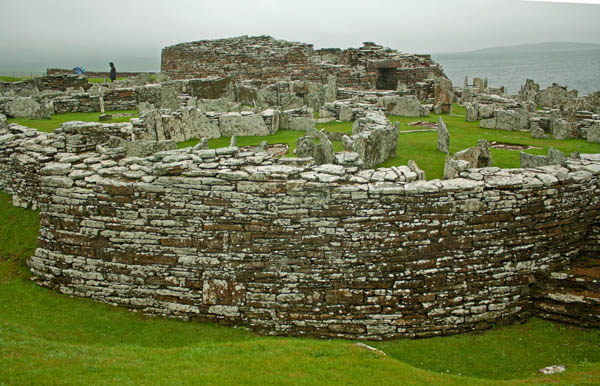
Broch of Gurness, Orkney mainland. © J. Lynn Stapleton, 28th July 2013
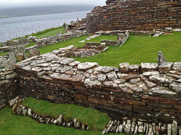
Broch of Gurness, Orkney mainland. © J. Lynn Stapleton, 28th July 2013
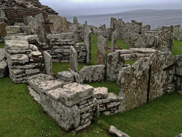
Broch of Gurness, Orkney mainland. © J. Lynn Stapleton, 28th July 2013
A Pictish Farm, Broch of Gurness, Orkney Mainland. © J. Lynn Stapleton, 28th July 2013

Broch Horse, Orkney mainland. © J. Lynn Stapleton, 28th July 2013
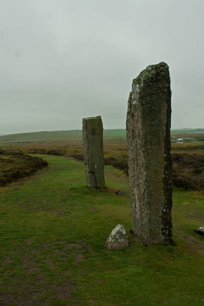
On our trails of viewing the heart of Neolithic Orkney, we stopped at The Ring of Brodgar, built relatively between 2500 BC and 2000 BC. The overcast day added to the mystery and ambiance of the scene in front of us. There are twenty-seven of a possible sixty stones survive around the circumference of the henge. Following that, we moved over to The Standing Stones of Stenness, which radiocarbon dating has set the building time around 3100 BC.
Ring of Brodgar
Ring of Brodgar, Orkney mainland. © J. Lynn Stapleton, 28th July 2013

Ring of Brodgar, Orkney mainland. © J. Lynn Stapleton, 28th July 2013
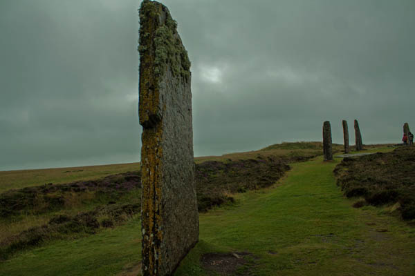
Ring of Brodgar, Orkney mainland. © J. Lynn Stapleton, 28th July 2013
Standing Stones of Stenness
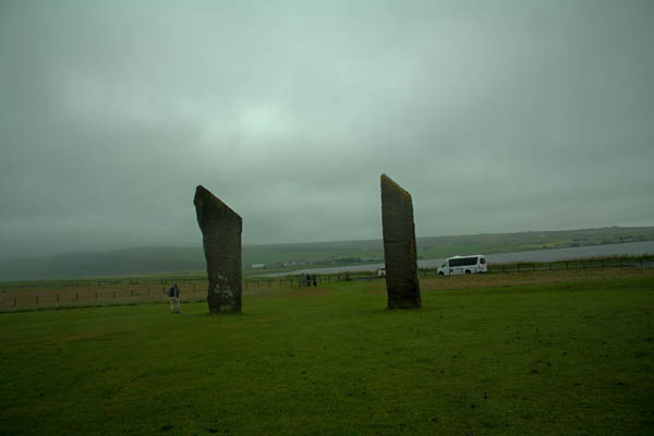
Stones of Stenness, Orkney mainland. © J. Lynn Stapleton, 28th July 2013

Stones of Stenness, Orkney mainland. © J. Lynn Stapleton, 28th July 2013
The Stones of Stenness was our last stop on the day’s itinerary before we headed back to Kirkwall. As I had leftovers from my Indian meal the night before back at the hostel, I decided to get dropped back to the Tesco’s near the hostel where I picked up some fruit and drink for the next day and a new pair of dry jeans. It hard started to sprinkle with rain again as I left Tesco’s but fortunately it wasn’t far back to the hostel. After getting in and hanging up my clothes on the heated towel rack and the radiator (which I turned up for the evening), I grabbed a nice hot shower then put on my pyjamas, got my supper then retired to my room to write up some postcards and work on my computer before retiring for the night.
